Remote Sensing
Advertisement
PHOTOMOD v.4.4.722
PHOTOMOD software family comprises a wide range of products for photogrammetric processing of the remote sensing data which allow to extract geometrically accurate spatial information from almost any commercially available type of imagery obtained by
Advertisement
InterIMAGE v.1 27
InterIMAGE is an open source knowledge based framework for automatic image interpretation. You can embed your knowledge into the system to automatically interpret remote sensing images. You can model your knowledge by creating a semantic network.
Monteverdi-1.8 v.1 8
Monteverdi is an application for capacity building to provide simple remote sensing data analysis tools for non-experienced users. Features: -Different tools can be accessed using the menu.
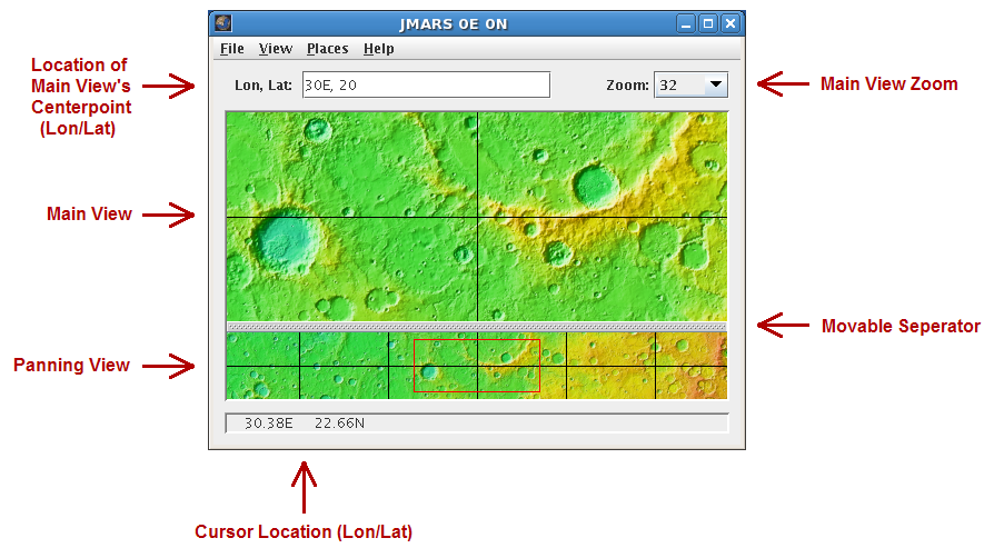
JMARS v.1.25
JMARS is an acronym that stands for Java Mission-planning and Analysis for Remote Sensing.
Echoproc v.0.1.4
Echoproc is a piece of scientific analysis software used to extract physical ice sheet characteristics from radio echograms from experiments like the Center for the Remote sensing of ice sheets (https://www.
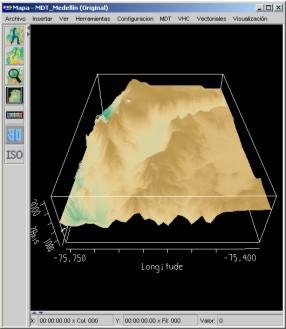
HidroSIG v.3.1.1.beta2
HidroSIG is a GIS that supports raster and vectorial maps with modules oriented to the hydrological analysis, time series, remote sensing and more.
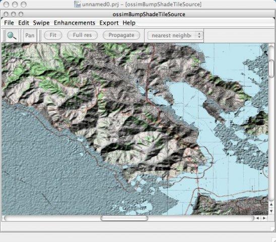
OSSIM - Open Source Software Image Map v.99
Open Source Remote Sensing OSSIM project, pronounced "awesome", will leverage existing algorithms/tools/packages from the open source community in construction of the ultimate Remote Sensing/Image Processing/GIS package.
RAT - Radar Tools v.0.21
RAT is a software for advanced image processing of SAR (Synthetic Aperture Radar) remote sensing data.
RSGISLib v.b.1.6.4
The remote sensing and GIS library is a set of C++ libraries and commands for the processing of spatial data (raster, vector and point cloud).
FreeView v.10 3
Geomatica FreeView is a flexible data viewing tool supporting over 100 raster and vector formats for loading, viewing, selection, and enhancement. FreeView is useful for any geospatial data viewing application, and is freely distributable.
TerrainView v.4.2.0.5
TerrainView is ViewTec's free 3D viewer. It allows the interactive visualization of 3D terrains and 3D models.